


Description
WaypointTool
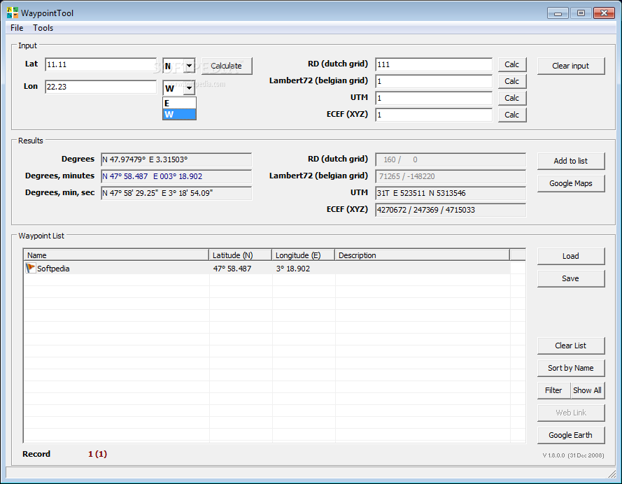
WaypointTool is a handy app designed to help you manage waypoints easily. Whether you're into geocaching or just want to keep track of specific locations, this tool can really make things simpler. It allows you to calculate coordinates between the RD (Dutch Grid) and view waypoint locations right on Google Maps. Who knows, you might even discover more ways to use it!
Easy Coordinate Entry
Enter coordinates: You can input them in WGS84 format or RD format—whichever suits you best! The app supports various formats for degrees, minutes, and seconds. Plus, if you're into geocaching, you can enter your coordinates as a string like “N 51° 32.841 E 004° 16.389” in the first field. By default, it assumes you're working with North and East.
Supported File Formats
Waypoint list: The WaypointTool supports several file formats that make managing your waypoints a breeze:
- GPX: This is the standard file format for geocaching.
- LOC: An alternative file format also used for geocaching.
- OV2: Used by TomTom; it saves only names and coordinates.
- TXT: A simple home-brew format that consists of “latitude longitude ; name”.
Your Next Steps
If you're ready to give WaypointTool a try, head over to this welcome page. It's perfect for anyone needing an easy way to handle waypoints!
User Reviews for WaypointTool 1
-
for WaypointTool
WaypointTool is a handy tool for managing waypoints and converting coordinates. Great for geocaching enthusiasts and navigation purposes.