


Description
WaypointTool
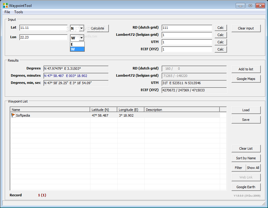
WaypointTool is a handy app made to help you manage your waypoints easily. It’s perfect for calculating coordinates between RD (Dutch Grid) and checking out waypoint spots on Google Maps. You might even discover more fun uses for it!
How to Enter Coordinates
You can enter your coordinates in either WGS84 or RD format. Feel free to use any type of degrees, minutes, and seconds that you like. If you’re into geocaching, you can also input a string like “N 51° 32.841 E 004° 16.389” right in the first field. The program usually defaults to North and East, so you're good to go!
Supported Waypoint Formats
The app works with several file formats for your convenience:
- GPX: This is the standard file format for geocaching.
- LOC: An alternative file format also great for geocaching.
- OV2: Used by TomTom, this format saves just the name and coordinates.
- TXT: A simple plain text format that includes “latitude longitude ; name”.
Download WaypointTool Today!
If you're ready to get started with managing your waypoints, check out this link. It's super easy and useful!
User Reviews for WaypointTool 1
-
for WaypointTool
WaypointTool is a user-friendly app for managing waypoints and converting coordinates. Useful for various purposes, with support for multiple file formats.