

Description
Seer3D
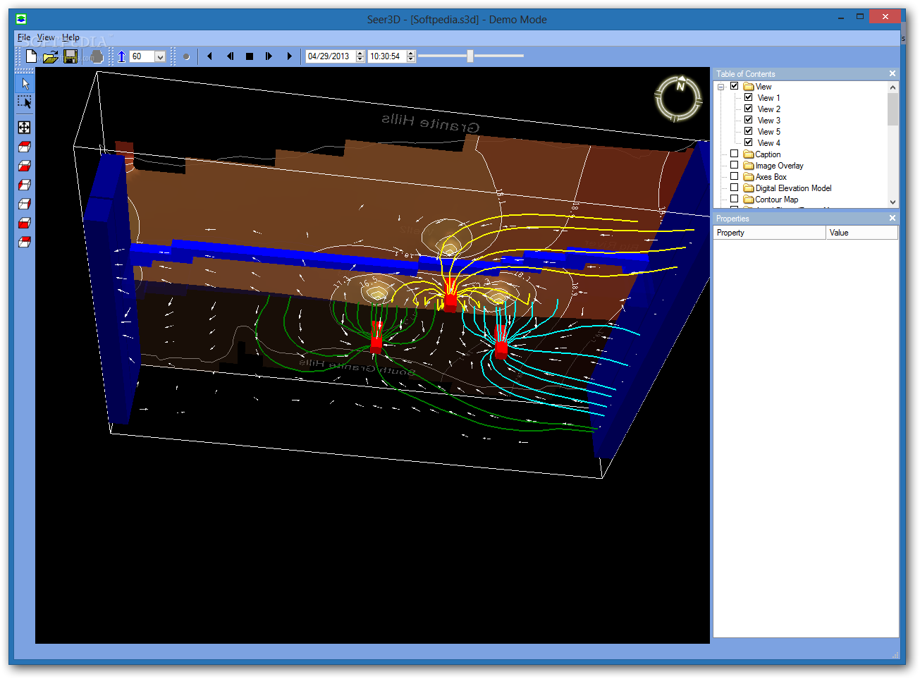
Seer3D is a super handy tool that helps you visualize field measurement data and create groundwater models. It's got some really powerful features that let you make cool animation videos. You can show off wells, boreholes, water level changes, flow vectors, and flow paths in a way that looks realistic.
Creating Realistic Maps
One of the coolest features is the Digital Elevation Model (DEM). This lets you create awesome representations of the ground surface terrain using elevation values. Plus, with aerial photographs, you can add geo-references to your models on flat planes, contour maps, and elevation models. Basically, you can whip up realistic maps using images in standard formats like PNG, TIF, or JPG.
File Compatibility
When it comes to compatibility, Seer3D plays nice with a bunch of common file formats. It supports USGS groundwater flow models like MODFLOW and MT3DMS as well as SEAWAT transport models. You can also use various reactive transport models such as RT3D, MT3D99, and PHT3D.
Vector Graphics Support
The app doesn’t stop there! It also supports vector graphics like the DXF format from Autodesk. This means you can easily share data between AutoCAD and other programs. And if you're into old-school stuff, it even handles polygons, polylines, and shapefiles.
Get Started with Seer3D!
If you're looking to dive into visualizing your data better and creating stunning animations for groundwater modeling, check out Seer3D. It's a game-changer in making complex data easy to understand!
User Reviews for Seer3D 7
-
for Seer3D
Seer3D is an incredible tool for visualizing groundwater data! The animations are stunning and very helpful.
-
for Seer3D
I love how easy it is to create realistic maps with Seer3D. The Digital Elevation Model feature is a game changer!
-
for Seer3D
This app has transformed the way I present my field data. The compatibility with various formats is fantastic!
-
for Seer3D
Seer3D offers powerful visualization tools that make understanding groundwater models a breeze. Highly recommend!
-
for Seer3D
Absolutely love this app! The flow vector field animations give great insights into groundwater dynamics.
-
for Seer3D
Seer3D's ability to integrate aerial photos with DEMs makes it stand out. A must-have for any geoscientist!
-
for Seer3D
Seer3D is a cutting-edge tool for visualizing field measurement data and groundwater models. Its animation feature adds a realistic touch.