

Description
SAGA GIS
SAGA (System for Automated Geoscientific Analyses) GIS is a super handy, open-source software that helps you with geospatial data analysis. It’s free and works on different operating systems, making it really flexible for everyone!
What Makes SAGA GIS Special?
This software has a cool object-oriented design that sets it apart. You’ll find a large and ever-growing collection of methods for geoscience right at your fingertips. Plus, its modular structure allows users to create functions that don't depend on any specific framework.
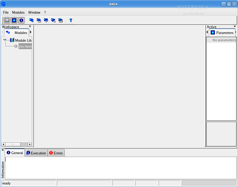
User-Friendly Interface
The Graphical User Interface (GUI) of SAGA GIS is easy to navigate. You can manage your data intuitively, and there are tons of options for visualization and analysis.
Impressive Features
One of the best parts? SAGA supports over 450 functions for geographical data analysis! Whether you’re looking at terrain or doing image analysis, this software has got you covered. It even supports scripting through the command-line with languages like Java, Python, and R!
Tools You Can Count On
SAGA comes loaded with great vector tools such as buffer zones, raster-to-vector conversion, and clipping tools. And don’t forget about its awesome terrain analysis features like classification and hydrology!
Advanced Analysis Options
If you're into image analysis, you'll love tools like Object-Based Image Analysis (OBIA), Fast Fourier Transform (FFT), and Principal Component Analysis (PCA). There are also several geostatistical functions available including Kriging methods!
Cross-Platform Support
The entire software is written in C++ using the wxWidgets framework for the GUI. It’s designed to work across platforms like GNU/Linux, FreeBSD, and Microsoft Windows—supporting both 64-bit and 32-bit hardware.
You can easily get started by downloading it from here!
User Reviews for SAGA GIS FOR LINUX 7
-
for SAGA GIS FOR LINUX
SAGA GIS FOR LINUX is a powerful open-source tool offering robust geoscientific methods, intuitive GUI, and over 450 functions for spatial analysis.
-
for SAGA GIS FOR LINUX
SAGA GIS is an outstanding tool for geospatial analysis. The intuitive interface makes it easy to explore various functions, and the extensive library of algorithms is impressive. Highly recommend!
-
for SAGA GIS FOR LINUX
I'm amazed by SAGA GIS! The range of features for terrain analysis and image processing is incredible. It's user-friendly, and the support for multiple programming languages is a huge plus!
-
for SAGA GIS FOR LINUX
SAGA GIS has transformed my workflow! Its powerful geostatistics functions and visualization tools make complex analyses straightforward. Plus, it's free and open-source—what's not to love?
-
for SAGA GIS FOR LINUX
Fantastic software! SAGA GIS provides an intuitive GUI along with robust command-line capabilities. The variety of geoscientific methods available is unmatched in any other free tool I've used.
-
for SAGA GIS FOR LINUX
SAGA GIS stands out as a top-tier open-source GIS application. The modular structure allows for flexibility, and I appreciate the comprehensive documentation that helps navigate its many functions.
-
for SAGA GIS FOR LINUX
I absolutely love using SAGA GIS! It supports so many functions for data analysis, making my projects more efficient. The community around it is also supportive, which enhances the experience.