
Description
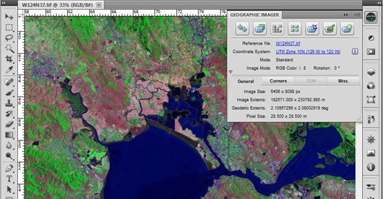
Geographic Imager
Geographic Imager is a super handy tool that makes working with raster imagery a breeze. If you're into mapping and love using Adobe Photoshop, this software is perfect for easily handling spatial images.
Easy Importing and Editing
With Geographic Imager, you can import, edit, and export geospatial images like aerial or satellite photos without breaking a sweat. It adds extra tools to Photoshop that let you manipulate your images just the way you want.
Photoshop Functions at Your Fingertips
You get to enjoy all the cool native functions of Adobe Photoshop! Think transparencies, filters, pixel editing, and image adjustments such as brightness and contrast. Plus, it keeps all your spatial references intact while you're at it!
Supports Multiple Formats
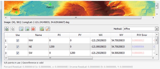
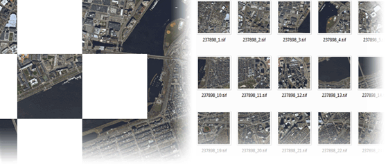
This software works well with GeoTIFFs in Adobe Photoshop and other popular raster formats too. You can mosaic and tile images, change projections, transform pictures, correct them, and georeference based on ground control points.
Batch Processing Made Simple
If you have lots of imagery to handle, Geographic Imager lets you batch-process everything using Adobe Photoshop's scripting features. It really speeds things up! And if you're using MAPublisher for Adobe Illustrator? No problem! Prepare your images in Geographic Imager before putting them into MAPublisher.
New Features You'll Love
Here are some cool updates in the latest version of Geographic Imager:
- Fully compatible with Adobe Photoshop CS5.1 (also known as Photoshop 12.1).
- A new Pixel-As-Point option when saving GeoTIFF images uses the center of the pixel as a reference point.
- A Create Single Layer option in Terrain Shader helps create a single colorization layer when multiple DEM layers are present.
- Plus various bug fixes and performance improvements!
If you're ready to give it a try or want more info about how Geographic Imager can help you out with mapping projects, check out their page!
Tags:
User Reviews for Geographic Imager FOR MAC 1
-
for Geographic Imager FOR MAC
Geographic Imager FOR MAC simplifies raster imagery manipulation in Adobe Photoshop. Easy import, edit, and export geospatial images with native Adobe functions.