
Description
ossimPlanet
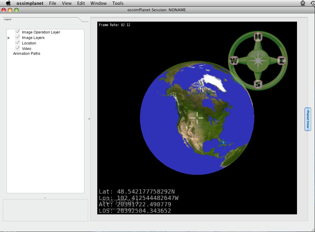
ossimPlanet is a really cool 3D global geo-spatial viewer. It’s built on some awesome open-source software libraries like OSSIM, OpenSceneGraph, and Trolltech QT. This means you’re getting a tool that’s not only powerful but also flexible!
What Can ossimPlanet Do?
This software gives you native geo-spatial access to all sorts of commercial and government data formats. Plus, it has super high-performance visualization and collaboration features. So whether you're analyzing data or working with a team, ossimPlanet makes it easy to see what you need!
Why Is ossimPlanet Important?
You might wonder why ossimPlanet matters so much. Well, it's a key part of the Large Data Joint Capabilities and Technology Development project. This means it's used for some pretty important stuff in the tech world!
Collaboration Made Easy
With ossimPlanet, you can achieve accurate 3D global visualization and collaboration like never before. You can even sync instances of the software for distributed teamwork! Imagine working on a project together from different locations—how great is that?
Easy Access to Data Sets
The software supports many different data sets, including:
- OSSIM Geo-Spatial Formats
- GDAL Geo-Spatial Formats
- OGC WMS Interface
- WorldWind Servers
- Pixia NUI format
- KML/KMZ files
- Precision Lightworks Urban Models
If you're into geo-spatial data and need an easy way to visualize it all in 3D, ossimPlanet could be exactly what you're looking for!
Tags:
User Reviews for ossimPlanet FOR MAC 1
-
for ossimPlanet FOR MAC
ossimPlanet FOR MAC offers accurate 3D global visualization and collaboration. Synchronized instances for distributed collaboration make it a powerful tool.